

Looking at pictures of properties might not seem like a big deal, but for insurance folks, it’s becoming super important. When you’re trying to figure out if insuring a place is a good idea, seeing what it actually looks like can tell you a lot. This isn’t just about whether the paint is peeling; it goes deeper into understanding the real risks involved. We’re talking about using property imagery underwriting analysis to get a clearer picture before making any big decisions.
Key Takeaways
- The core idea of insurance relies on honesty and making sure everyone involved is upfront about what they know. This applies big time when looking at property photos for insurance.
- Visuals from property imagery can help spot physical problems, like a worn-out roof or overgrown trees near the house, which are clear signs of risk.
- By analyzing images, insurers can better judge the actual condition of a property and whether it’s being looked after, which directly impacts how risky it is.
- Pictures can reveal if someone isn’t being totally honest about the property’s condition or features, helping to prevent fraud and ensure accurate pricing.
- Technology like drones and AI is changing how we use property photos, making the whole process of property imagery underwriting analysis faster and more accurate.
Foundational Principles of Property Imagery Underwriting Analysis
When we look at property imagery for underwriting, it’s not just about seeing what’s there. It’s about understanding the underlying rules and responsibilities that govern insurance. Think of it like building a house; you need a solid foundation before you can start putting up walls. The same applies here. We’re talking about core ideas that have been around for ages in the insurance world, and they’re just as important when we bring visual data into the mix.
The Utmost Good Faith Principle in Property Transactions
This is a big one. The principle of utmost good faith, or uberrimae fidei, means that everyone involved in an insurance contract – that’s the applicant and the insurer – has to be completely honest. No hiding things, no misleading statements. For property insurance, this means the person applying for coverage has to tell the insurer everything important about the property that could affect the risk. If you know your roof has a leak, you can’t just ignore it and hope the insurer doesn’t notice. Honesty is the bedrock of the entire insurance relationship. This principle is so important that if it’s violated, the whole contract can be called into question, and claims might not be paid.
Disclosure Obligations and Material Fact Identification
Following closely from utmost good faith are disclosure obligations. This is where the rubber meets the road regarding what needs to be shared. Applicants are required to disclose what are called ‘material facts’. What’s a material fact? It’s any piece of information that would influence an underwriter’s decision about whether to offer coverage, and if so, on what terms and at what price. This could be anything from the age of the building to the type of heating system, or even if there’s a swimming pool. When we use property imagery, we’re often looking for these material facts visually. We might spot a poorly maintained fence, an overgrown yard that suggests neglect, or even evidence of past damage that wasn’t disclosed. Identifying these visual cues helps us understand the real risk associated with the property.
Here’s a quick look at what counts:
- Physical Condition: Obvious signs of wear and tear, damage, or lack of maintenance.
- Environmental Factors: Proximity to flood zones, dense vegetation that could be a fire hazard, or other geographic risks.
- Property Features: Things like swimming pools, trampolines, or certain types of roofing that might increase liability or specific perils.
- Occupancy and Use: Evidence of commercial activity in a residential zone, or signs of vacancy.
The goal is to get a clear picture of the risk, not just based on what’s said, but also on what can be seen. This visual inspection complements the information provided by the applicant, helping to ensure accuracy and fairness.
Understanding Insurable Interest in Property Insurance
Finally, there’s the concept of insurable interest. Simply put, you can only insure something if you stand to suffer a financial loss if it’s damaged or destroyed. You can’t take out an insurance policy on your neighbor’s house just because you like looking at it. You need to have a legitimate financial stake in the property. For property insurance, this insurable interest generally needs to exist both when the policy is taken out and at the time of the loss. If you sell your house, you no longer have an insurable interest in it, so your old policy wouldn’t cover any damage that happens after the sale. Imagery can sometimes help confirm ownership or occupancy, which are key indicators of insurable interest, though it’s not the primary method for establishing it.
Leveraging Property Imagery for Risk Assessment
When we look at a property, we’re not just seeing a building or a piece of land. We’re seeing a collection of potential risks. Property imagery, whether from a drone, satellite, or even a street-level photo, gives us a visual snapshot that can tell us a lot about what might go wrong. It’s like getting a peek behind the curtain, showing us things that might not be obvious from paperwork alone.
Identifying Physical Hazards Through Visual Inspection
This is where imagery really shines. You can spot a lot of physical problems just by looking. Think about it: cracked foundations, missing shingles, overgrown vegetation too close to the structure, or even standing water around the property. These aren’t just cosmetic issues; they’re red flags for potential claims. A roof that’s seen better days, for instance, is a prime candidate for wind or hail damage. Overgrown trees can fall during a storm, and poor drainage can lead to water damage or foundation problems. Visual inspection of property imagery allows for the proactive identification of physical hazards that could lead to future claims.
- Roof Condition: Look for missing, curled, or damaged shingles, as well as signs of wear or moss growth.
- Foundation Integrity: Check for visible cracks, settling, or water pooling near the foundation.
- Vegetation Management: Assess the proximity of trees and shrubs to the building; overhanging branches are a concern.
- Drainage: Observe the grading around the property and look for any areas where water might collect.
The visual cues present in property imagery can often signal underlying issues that require attention before they escalate into costly claims. It’s about seeing the story the property tells through its physical state.
Assessing Property Condition and Maintenance Levels
Beyond immediate hazards, imagery helps us gauge how well a property is being looked after. A well-maintained property generally suggests a responsible owner, which can translate to lower risk. We can see if the paint is peeling, if fences are in disrepair, or if the overall property looks neglected. This isn’t just about aesthetics; it speaks to the owner’s attitude towards upkeep. A property that’s falling apart might be more susceptible to damage and less likely to be repaired promptly if a loss occurs. This ties into understanding insurable interest in property insurance – a well-maintained property is more likely to be valued and protected by its owner.
Evaluating Geographic Exposure and Environmental Factors
Imagery also gives us a bird’s-eye view of the property’s surroundings. Is it located in a flood zone? Is it near a wildfire-prone area? How close are neighboring structures? These geographic factors are huge risk drivers. We can see if the property is isolated or part of a dense urban area, which affects fire spread. We can also spot environmental concerns, like proximity to industrial sites or bodies of water that might pose specific risks. For example, understanding transportation liability severity can be informed by the property’s location relative to major transport routes or potential environmental hazards. This kind of information is vital for understanding the overall risk profile, especially for commercial properties or those in areas prone to natural disasters, like those covered under Owner-Controlled Insurance Programs (OCIPs).
Analyzing Imagery for Underwriting Decisions
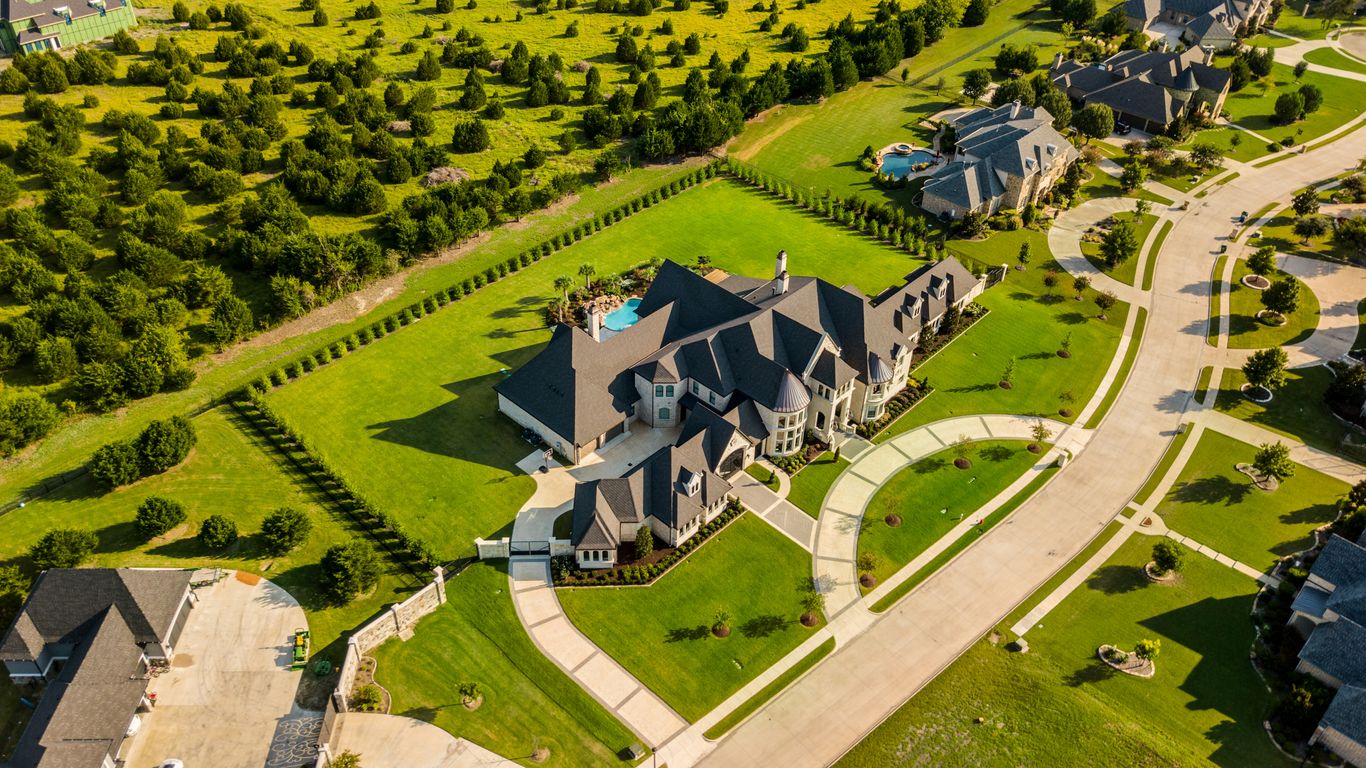
Looking at property images isn’t just about seeing what a place looks like; it’s about digging into the details that matter for underwriting. We’re trying to get a clearer picture of the risk involved, and visual data can really help with that. It’s like getting a second opinion, but from a photo.
Quantifying Property Characteristics from Visual Data
When we look at images, we’re not just noting if there’s a pool or a nice garden. We’re trying to measure things. For example, we can estimate the roof’s age based on its condition, or the general upkeep of the landscaping. We can also get a sense of the building’s size and layout, which helps in determining replacement costs. It’s about turning what we see into numbers that fit into our underwriting models. This helps us get a more accurate idea of the property’s value and potential issues.
- Roof condition (e.g., age, material, visible damage)
- Exterior maintenance (e.g., siding condition, paint, window integrity)
- Yard and landscaping (e.g., tree proximity to structures, general upkeep)
- Building footprint and apparent stories
Detecting Non-Disclosure and Misrepresentation
Sometimes, what’s in the pictures doesn’t quite match what the applicant told us. This is where imagery becomes a powerful tool for spotting discrepancies. If an applicant says there’s no pool, but the aerial photo clearly shows one, that’s a red flag. Or if they claim the property is in excellent condition, but the images show significant wear and tear, we need to investigate further. This visual verification is key to upholding the principle of utmost good faith in insurance. It helps us ensure that the information we’re using to underwrite is accurate and complete. It’s not about catching people out, but about making sure the policy accurately reflects the risk. This is important for fair claims handling.
The goal here is to ensure that the policy accurately reflects the risk presented by the property. Discrepancies between visual evidence and applicant statements can indicate a need for further inquiry or adjustments to the underwriting decision. It’s about transparency and making sure everyone is on the same page regarding the property’s condition and features.
Enhancing Risk Classification Accuracy
By using imagery, we can refine how we classify risks. Instead of relying solely on broad categories, we can get more specific. For instance, we can identify properties with features that might increase risk, like a trampoline in the backyard or a detached structure that’s not well-maintained. These details, when captured visually, allow us to place the property into a more appropriate risk category. This leads to more accurate pricing and coverage terms, which is better for both the insurer and the policyholder. It helps prevent situations where a higher-risk property is priced like a lower-risk one, which can lead to problems down the line, especially during claims assessment.
The Role of Imagery in Loss Prevention and Mitigation
Looking at property images isn’t just about spotting current problems; it’s a powerful tool for stopping future losses before they even happen. Think of it as a proactive approach to insurance. By carefully examining visual data, underwriters can get a real sense of a property’s condition and identify potential issues that could lead to claims down the line. This isn’t just about ticking boxes; it’s about genuinely reducing risk for everyone involved.
Identifying Potential Loss Drivers in Property Imagery
When you’re looking at photos or drone footage of a property, you’re not just seeing walls and roofs. You’re seeing clues. Things like overgrown vegetation close to the house can be a fire hazard, especially in dry areas. Poorly maintained gutters might suggest water damage is likely to occur. Even the type of roofing material and its age can tell you a lot about its susceptibility to damage from hail or wind. We’re essentially looking for physical conditions that make a loss more probable.
- Roof Condition: Missing shingles, sagging areas, or excessive moss can indicate a need for replacement and potential leaks.
- Vegetation Management: Overhanging trees or brush too close to structures can be fire risks or cause damage during storms.
- Drainage Systems: Clogged or damaged gutters and downspouts can lead to water pooling and foundation issues.
- Exterior Maintenance: Peeling paint, damaged siding, or visible cracks can point to underlying structural problems or water intrusion.
The goal here is to spot the ‘weak links’ in a property’s defense against the elements and everyday wear and tear. It’s about seeing the potential for problems before they become actual claims.
Incentivizing Risk Mitigation Measures
Once we identify these potential loss drivers, we can use that information to encourage property owners to make improvements. It’s not about punishing people, but about working together. For instance, if an image shows a property with an old, worn-out roof, an underwriter might suggest a discount on the premium if the owner agrees to replace it. Or, if there’s a clear fire risk from nearby trees, we might recommend trimming them back. This approach helps policyholders protect their assets and, in turn, reduces the insurer’s exposure. It’s a win-win situation that promotes better risk management programs.
Validating Loss Control Initiatives
Imagery also plays a role after a property owner has taken steps to reduce risk. Let’s say a policyholder installed a new fire-resistant roof or cleared brush away from their home. We can use updated imagery to verify that these mitigation efforts have been completed as agreed. This validation is important for several reasons. It confirms that the risk reduction measures are in place, which can justify premium adjustments. It also provides a visual record that can be helpful if a claim does occur later, showing that the property was maintained to a certain standard. This ongoing visual check-in helps maintain the integrity of the underwriting process and keeps the insurance relationship on solid ground.
Integrating Imagery with Underwriting Data
It’s not enough to just look at a property’s photos and call it a day. To really get a handle on the risk, we need to weave that visual information into the bigger picture. This means combining what we see in images with all the other data we have about a property and its owner. Think of it like putting together a puzzle; each piece of information, whether it’s from a drone shot or a property record, helps us see the whole risk more clearly.
Combining Visual Evidence with Traditional Data Sources
When we look at property imagery, we’re gathering visual clues. But these clues are much more powerful when they’re paired with information from other sources. We might see a well-maintained roof in a photo, but what does the property’s claims history say? Is there a history of leaks or storm damage? Combining these different data points gives us a more complete understanding. For example, we can cross-reference the apparent age of a roof in an image with the actual installation date from property records. If they don’t match up, it’s a flag.
Here’s a look at how different data types can work together:
- Property Records: Age of the building, square footage, previous ownership, permits issued.
- Claims History: Past losses, frequency and severity of claims, types of damage.
- Geographic Data: Flood zones, seismic activity, proximity to fire stations or hydrants.
- Imagery Data: Roof condition, presence of debris, swimming pool safety, tree overhang, general upkeep.
The goal is to create a layered view of risk. No single data point tells the whole story, but together, they paint a much clearer picture for underwriting decisions.
Utilizing Claims Data for Imagery Validation
Claims data is a goldmine for checking if our visual assessments are on the right track. If our imagery analysis suggests a property is in excellent condition, but we see a pattern of frequent, costly claims related to structural issues or water damage, something doesn’t add up. This discrepancy can point to issues not visible in standard imagery, or perhaps a need to re-evaluate how we interpret certain visual cues. It helps us refine our risk assessment models. For instance, if claims data shows a high incidence of roof leaks in a specific geographic area, and our imagery shows many older roofs in that same area, it validates the need for closer scrutiny of roof age and condition during underwriting. This feedback loop is vital for improving the accuracy of our underwriting process and ensuring we’re pricing risk appropriately. It’s about learning from past events to better predict future ones.
Developing Predictive Models with Image Analytics
This is where things get really interesting. By feeding the insights we gain from property imagery into predictive models, we can start forecasting risk with greater accuracy. These models can identify patterns that might be too subtle for a human underwriter to spot consistently. For example, a model might learn that a combination of specific roof materials, a certain tree overhang distance, and proximity to a wildfire-prone area significantly increases the likelihood of a claim. This allows us to move beyond simply assessing current conditions to predicting future loss potential. It’s about using the visual data to build a more forward-looking underwriting process. The more data we feed these models, including historical claims and imagery, the smarter they become at identifying potential risks before they lead to losses.
Technological Advancements in Property Imagery Analysis
It feels like just yesterday we were relying solely on paper applications and manual inspections. Now, technology is really changing the game for how we look at properties for underwriting. It’s not just about getting a general idea anymore; we’re getting incredibly detailed insights.
The Impact of Artificial Intelligence on Image Interpretation
Artificial intelligence (AI) is a big part of this shift. Think about it: AI can sift through thousands of images way faster than any person. It’s trained to spot specific things, like roof conditions, the presence of certain types of vegetation near a structure, or even the general upkeep of a property. This helps underwriters focus on the really important stuff. AI algorithms can identify subtle patterns and anomalies that might be missed by the human eye. This means we can get a more consistent assessment across many properties.
Leveraging Drones and Satellite Imagery
Drones and satellite imagery have opened up a whole new perspective. Drones can get super close-up views of specific properties, capturing high-resolution details that are perfect for assessing things like roof damage, the condition of outbuildings, or the state of the yard. Satellite imagery, on the other hand, gives us a broader view. It’s great for understanding the property’s surroundings, like its proximity to flood zones, wildfire-prone areas, or even major roadways. This kind of geographic context is invaluable for risk assessment. For example, we can use this data to understand risks associated with renewable energy systems by looking at surrounding environmental factors.
Automating Property Imagery Underwriting Workflows
Putting all this together, we’re seeing a move towards automating parts of the underwriting workflow. Instead of manually pulling up images and trying to interpret them, systems can now do a lot of the heavy lifting. This automation helps speed up the process, allowing underwriters to handle more applications and make decisions faster. It also helps in standardizing the analysis, reducing variability between different underwriters. This is part of a larger trend where advanced analytics are revolutionizing insurance by making risk assessment more precise and efficient.
Addressing Challenges in Property Imagery Underwriting
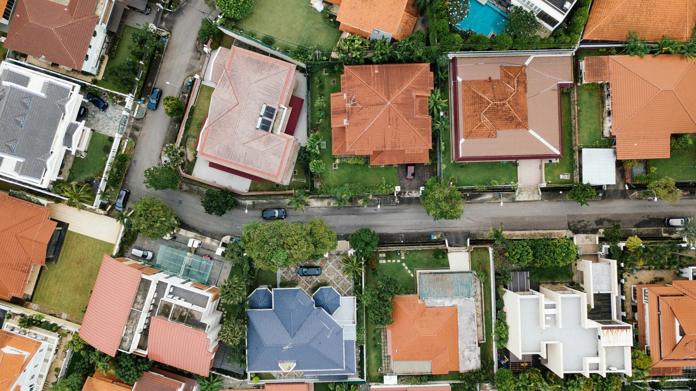
While property imagery offers a powerful new lens for underwriting, it’s not without its hurdles. We have to be mindful of a few key areas to make sure we’re using this data responsibly and effectively. It’s a bit like trying to bake a cake with a new recipe – you need the right ingredients and you have to follow the steps carefully, or things can go wrong.
Ensuring Data Privacy and Security
This is a big one. When we’re looking at images of people’s homes, we’re dealing with sensitive information. We need to make sure that we’re handling this data with the utmost care. That means keeping it secure, not sharing it unnecessarily, and being really clear with policyholders about what information we’re collecting and how we’re using it. It’s about building trust, and that starts with respecting people’s privacy. We can’t just go around collecting images without a solid plan for keeping them safe and private.
- Secure Storage: Implementing robust encryption and access controls for all image data.
- Anonymization Techniques: Where possible, anonymizing data to remove personally identifiable information.
- Clear Consent: Obtaining explicit consent from policyholders regarding the use of imagery.
- Data Minimization: Only collecting and retaining imagery that is strictly necessary for underwriting purposes.
The ethical use of property imagery hinges on a commitment to safeguarding personal information. Transparency and robust security measures are not just good practice; they are fundamental to maintaining the integrity of the underwriting process and public confidence.
Mitigating Bias in Algorithmic Analysis
AI is great for spotting patterns, but it can also pick up on biases that exist in the data it’s trained on. If our training data isn’t diverse or representative, our algorithms might unfairly flag certain properties or neighborhoods. This could lead to discriminatory outcomes, which is something we absolutely want to avoid. We need to actively work to identify and correct these biases to make sure our underwriting is fair for everyone. It’s a constant effort to refine the models and check for unintended consequences.
| Bias Type | Potential Impact on Underwriting |
|---|---|
| Socioeconomic | Unfairly penalizing properties in lower-income areas. |
| Geographic | Overlooking specific risks or opportunities in certain regions. |
| Algorithmic | AI models perpetuating historical underwriting biases. |
| Data Representation | Training data not reflecting the full diversity of properties. |
Navigating Regulatory Compliance for Imagery Use
The rules around data usage are always changing, and that includes how we can use images. We need to stay on top of all the relevant laws and regulations, both at the state and federal level. This might involve understanding things like data privacy laws, fair housing regulations, and any specific rules about using aerial or satellite imagery. It’s a complex landscape, and getting it wrong can lead to serious penalties. Staying informed and adapting our practices is key to operating legally and ethically. We have to make sure our use of imagery aligns with all applicable laws and regulations.
- Understanding state-specific data privacy laws.
- Ensuring compliance with fair housing acts.
- Adhering to guidelines for data retention and destruction.
- Keeping abreast of evolving regulations concerning AI and data analytics.
The Future of Property Imagery in Insurance Underwriting
Evolving Underwriting Practices with Advanced Analytics
The way we assess property risk is changing, and fast. It’s not just about filling out forms anymore. We’re seeing a big shift towards using more data, and a lot of that data comes from images. Think about it: pictures of a property can tell you a lot about its condition, potential issues, and even its surroundings. This means underwriters are getting better tools to understand what they’re insuring. The integration of advanced analytics with property imagery is set to redefine risk assessment. We’re moving beyond just looking at past claims or basic property details. Now, we can analyze visual data to spot things like roof wear, overgrown vegetation near a structure, or even the proximity to known flood zones. This kind of detailed visual information helps create a more accurate picture of the risk involved. It’s about making underwriting smarter and more precise.
Enhancing Customer Experience Through Efficient Assessment
One of the biggest benefits of using imagery in underwriting is how it speeds things up for everyone. Instead of lengthy site visits or waiting for paperwork, insurers can get a good look at a property remotely. This means faster policy approvals and a smoother process for customers. Imagine applying for insurance and getting a quote much quicker because the insurer can assess your property visually. This efficiency is a game-changer. It reduces the time and effort required from both the applicant and the underwriter. Plus, it can lead to more consistent decisions because the visual data provides an objective reference point. This technology helps make the whole insurance experience less of a hassle.
The Strategic Importance of Visual Data in Risk Management
Looking ahead, visual data from property imagery is becoming a core part of how insurers manage risk overall. It’s not just for initial underwriting; it can be used throughout the life of a policy. For example, regular aerial or drone imagery can help insurers monitor changes to a property or identify emerging risks before they become major problems. This proactive approach to risk management is incredibly important. It allows insurers to intervene early, perhaps by suggesting mitigation steps to policyholders, or adjusting coverage if the risk profile changes significantly. This strategic use of visual data helps maintain a healthier insurance pool and protects against unexpected losses. It’s about building a more resilient and informed insurance system for the future. The ability to continuously monitor and assess properties visually provides a strategic advantage in managing the complex landscape of property risks. This approach is becoming increasingly vital for long-term stability and profitability in the insurance sector. Visual evidence is transforming how we view and manage risk.
Looking Ahead
So, we’ve talked about how looking at property pictures can really help when figuring out insurance risks. It’s not just about seeing if a roof looks old; it’s about spotting potential problems before they become big claims. This kind of visual check, combined with all the other data we use, just makes the whole underwriting process smarter. It helps us price things more fairly and avoid surprises down the line. As technology keeps getting better, we’ll probably see even more ways to use images and other data to get a clearer picture of the risks out there. It’s all about making better decisions today to keep things stable for tomorrow.
Frequently Asked Questions
What is property imagery underwriting, and why is it important?
Property imagery underwriting means using pictures and videos of a property to help decide if an insurance company should offer coverage and at what price. It’s important because it gives a clearer, real-world look at the property’s condition and potential risks, helping insurers make fairer and more accurate decisions.
How does looking at pictures help insurers assess risk?
By examining photos, insurers can spot potential problems like a worn-out roof, overgrown trees near the house, or poor upkeep. These visual clues help them understand how likely a property is to have damage or cause a claim, which is a big part of assessing risk.
Can property photos help find out if someone is hiding important information?
Yes, sometimes. If the pictures show issues that the property owner didn’t mention when applying for insurance, it might mean they weren’t completely honest. This helps insurers catch cases where important details were left out, which is crucial for fair insurance.
What kind of technology is used to analyze property images?
Nowadays, special computer programs, including those using artificial intelligence (AI), are used to ‘read’ the images. Drones and satellites also capture aerial views, giving a broader perspective of the property and its surroundings.
How does using images make insurance pricing better?
When insurers have a better idea of the actual risks involved, they can set prices that more accurately reflect those risks. This means safer properties might get better rates, and riskier ones are priced appropriately, leading to fairer pricing for everyone.
Can images help prevent future problems or damage?
Absolutely. By spotting potential hazards in photos, insurers can suggest ways for property owners to fix them before they cause a major issue. This helps prevent losses and keeps both the property owner and the insurance company safer.
Are there any downsides or challenges to using property images?
There can be. Insurers need to be careful about people’s privacy and make sure the technology they use doesn’t unfairly target certain groups. Following the rules and using the technology responsibly are key challenges.
What’s the future of using images in property insurance?
The use of images and smart technology is expected to grow a lot. It will likely make the insurance process faster, more accurate, and more convenient for customers, while helping insurers manage risks more effectively.